Posts

Showing posts with the label Mc Cloud River

McCloud River-Mt.Shasta
Image
 Was recently in Northern California for a few days. It was really good to get back up there. The McCloud River was running high and deep with the warm weather and the snow melt. The days were almost perfect. The California Lilac were prominent along the river and these were growing just in front of lava rock that is throughout the region. My brother and I took the Military Pass Road which goes around the back side of the mountain. We actually only made it part way (very slowly) until we met with snow drifts that were a little too deep. This is not a well maintained road. The north side of the mountain is generally very windy and this might explain the general lack of snow except in drifts. We also took a trip to Castle Lake which has an elevation of about 5400 feet.  This is actually lower than the Military Pass Road but had a lot more snow and still covered in snow and ice. Probably my favorite photo from the trip, parent and child enjoying the snow. Go, See, Enjoy, Stay Saf...

McCloud & Mt. Shasta

Image
I recently took a trip to the area where I grew up. The McCloud-Mt.Shasta area of Southern Siskiyou County in Northern California. As you may have heard there where and are a number of wildfires occuring in the area. The smoke was in fact very, very heavy at times. That limited my photography to mostly close up subjects. I tried to get above the smoke by going to the Mt.Shasta Ski Resort, about 7,000 feet. I couldn't get above the smoke even at that height. A little lower I  stopped to finally eat some breakfast and was pleasantly surprised. This is one of the first 'Flowers' I found.  You'll notice the name is Wild Carrot. Not sure why, but....... It has another name, 'Queen Anne Lace' just like the one below.  Yup, the one above is sans flowers, it's after all the petals are gone. I also saw a number of  butterflies fluttering about. None very cooperative for a photographer. Except this one. Have you ...

Mc Cloud River

Image
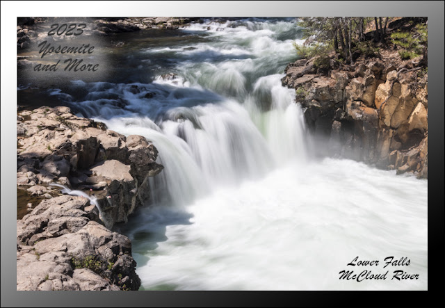
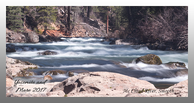
A couple of weeks ago I went up to the  McCloud River to do some fishing with my brother, family and friends. Due to a fishing reel mishap my line barely got wet. Sooooo I just happen to have my camera with me, what to do..... What to do? The river was and is running very high and fast, the most water I've seen this time of year that I can remember, which may not be all that long ago. Here's a couple of images of the river itself. The first is a longer exposure using a couple of neutral density filters. The second is what it really looks like. This is called Lower Falls. It seems much wider now than it used to. The winter river flow has definitely had an effect on the river and it's banks.   As I grew up we considered Manzanita almost a weed because it would take over an area and stifle tree growth, I grew up in a lumber town. Now I'm actually thinking of adding some to the landscaping of my yard. Go figure. Thr...

Mc Cloud River Walk

Image
A while back I went up to my home town for a small family reunion. While up there I took a stroll along the Mc Cloud River. This was my starting point, Lower Falls. The water is very cold but this is a popular swimming hole. This little guy was helpful by posing for me. I'm sure he was waiting for a tidbit to eat. Sorry. When I grew up we called these Golden Mantle Squirrels, I've since learned Golden Mantles are larger, the stripes go up to the face and are usually farther north. The Mc Cloud is a small river since this is near the beginning of the river. It gets much larger as it heads to Shasta Lake. It is actually larger than the Sacramento River when they reach Shasta Lake. The Mc Cloud River, Pitt River and Sacramento all contribute to the 'Sacramento River' below Shasta Dam. Shasta Lillies aren't hard to spot, but there aren't very many of them, so you feel lucky if you do spot one. If the lady I met on ...